Open 10:30–5:00, Tuesday – Saturday
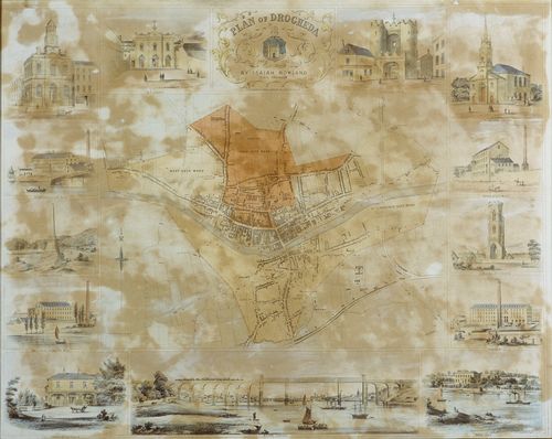
This lithograph was prepared around 1860 and is possibly earlier than a similar map of Kilkenny City published by Marlow’s of Capel Street, Dublin in 1861. The map which shows a street plan of Drogheda, including the historic wards (corporation electoral districts) of the town, is also illustrated with a series of fine pictures of key civic buildings, large private houses, the Boyne Viaduct and the major factories of the time. It contains illustrations of the since demolished Boyne Obelisk and the Catholic St. Peter’s Church, West Street (Architect: Francis Johnston).
